• 3D SCANNING
  • Services
  • Portfolio
  • About us
  • Contact
  • English
    • Magyar
    • Română
Menu
  • 3D SCANNING
  • Services
  • Portfolio
  • About us
  • Contact
  • English
    • Magyar
    • Română

01  

3D laser scanning

02  

Procession of cloud of points: filtering, digital noise removal, classification of clouds according to law criteria

03  

Site verification and support: comparison of the construction with the 3D CAD model of the project (colouring the cloud of points according to the volume of differences)

04  

Checking the design of walls and frames (colouring where there are differences)

05  

Video presentation of the cloud of points

06  

Presentation of the object (its external or internal volume does not matter) with the possibility of removing disturbing segments (furniture, vegetation, buildings, reliefs, etc.)

07  

Plan of technical positions and 360° panoramic photos taken by the scanner

08  

2D surveys: site plans, sections, facades depending on the complexity of the building and the desired scale

09  

3D CAD models

10  

Mesh

11  

Complex architectural design and restoration

12  

Virtual tour

RECOMMENDATIONS FOR A COMPLEX FINAL RESULT

The 3D laser scanner reveals almost any surface visible to the eye (except transparent or very bright ones). In the cloud of points will therefore appear what the person sees at the present moment. If an object or anything is covering the element being revealed, then it will not be part of the point cloud. Thus it is recommended to remove disturbing elements before scanning, e.g. parasite vegetation, scaffolding, protective nets, cars parked in front of the facade, objects, furniture in front of important walls, the curtain covering the window elements, water stains on the floor. If a person passes in front of the measuring device, he will also appear in the cloud of points, so a crossing point or an event with a large audience disturbs the measurements.

Historic building survey in Târgu Mures

If it is not possible to evacuate the building, then to have a clearer result, we recommend placing the furniture, and objects in the middle of the room and removing the curtains.

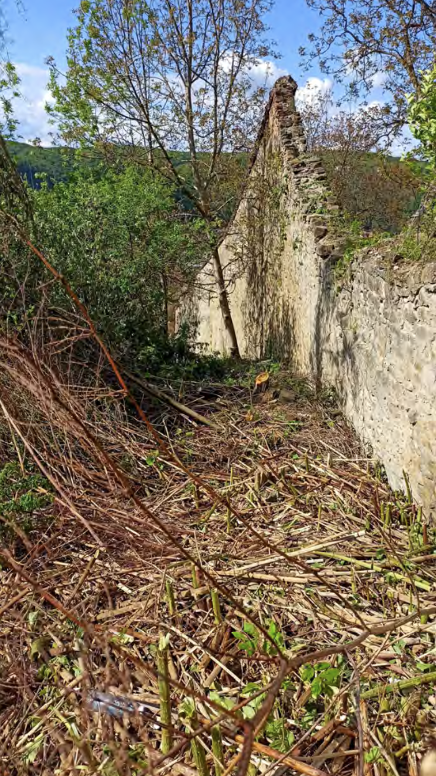
Medieval castle survey in Sighisoara

Removal of parasitic vegetation near the wall at a distance of 2-3m

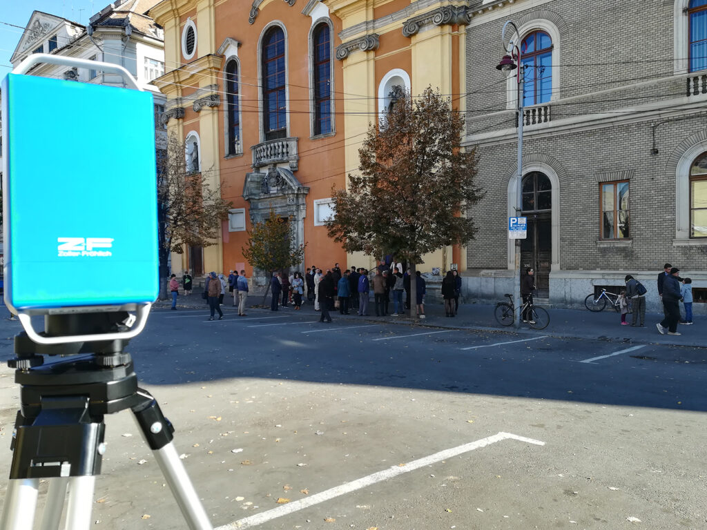
Survey of Farkas and University Street in Cluj Napoca

With the parking/restrictions the space became free of cars, but the exit of the people from the church stopped the measurements.

Case study

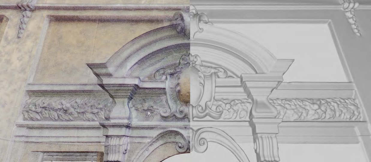
Ornaments of facades

The ornamental elements of the eclectic facade after the laser scanning passed through a density filter, so that a distance of 1 mm remained between the points, facilitating the creation of 2D technical drawings with a CAD program. The cloud of points was transformed into MESH, and a detailed 3D model is produced in the program using BIM elements. Thus it is easy to render the grandeur of the building in 3D format, which is more difficult with manual methods.

Case study

ORTOFOTO after a cloud of points

The surveying of a baroque gate was carried out at the same time as the scanning of the church of St. Peter and Paul in Cluj. For the 2D documentation of the gate it was decided to use orthophoto, taking into account the advantages of speed and details.

Case study

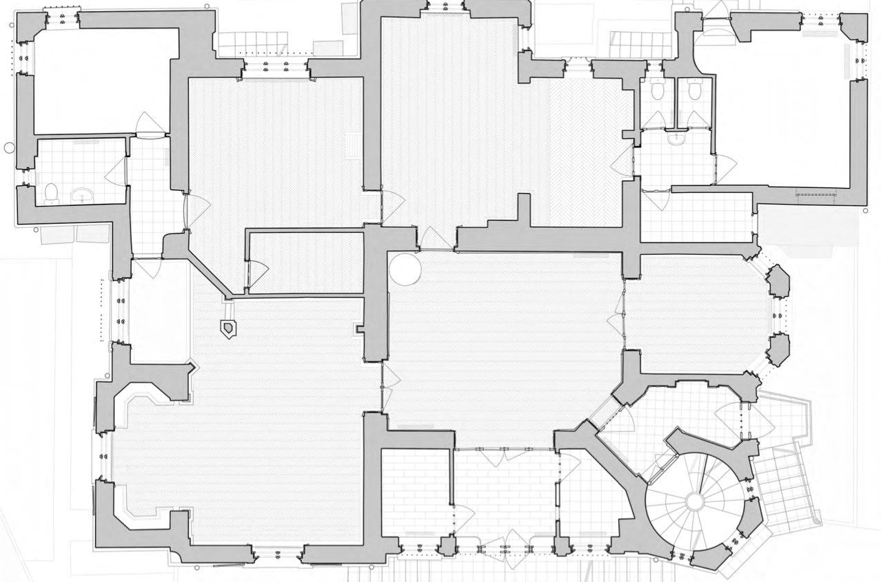
Detailed plan

Survey of Villa Pákei in Cluj. Situation plan drawn by colleagues at the office based on a cloud of points

Case study

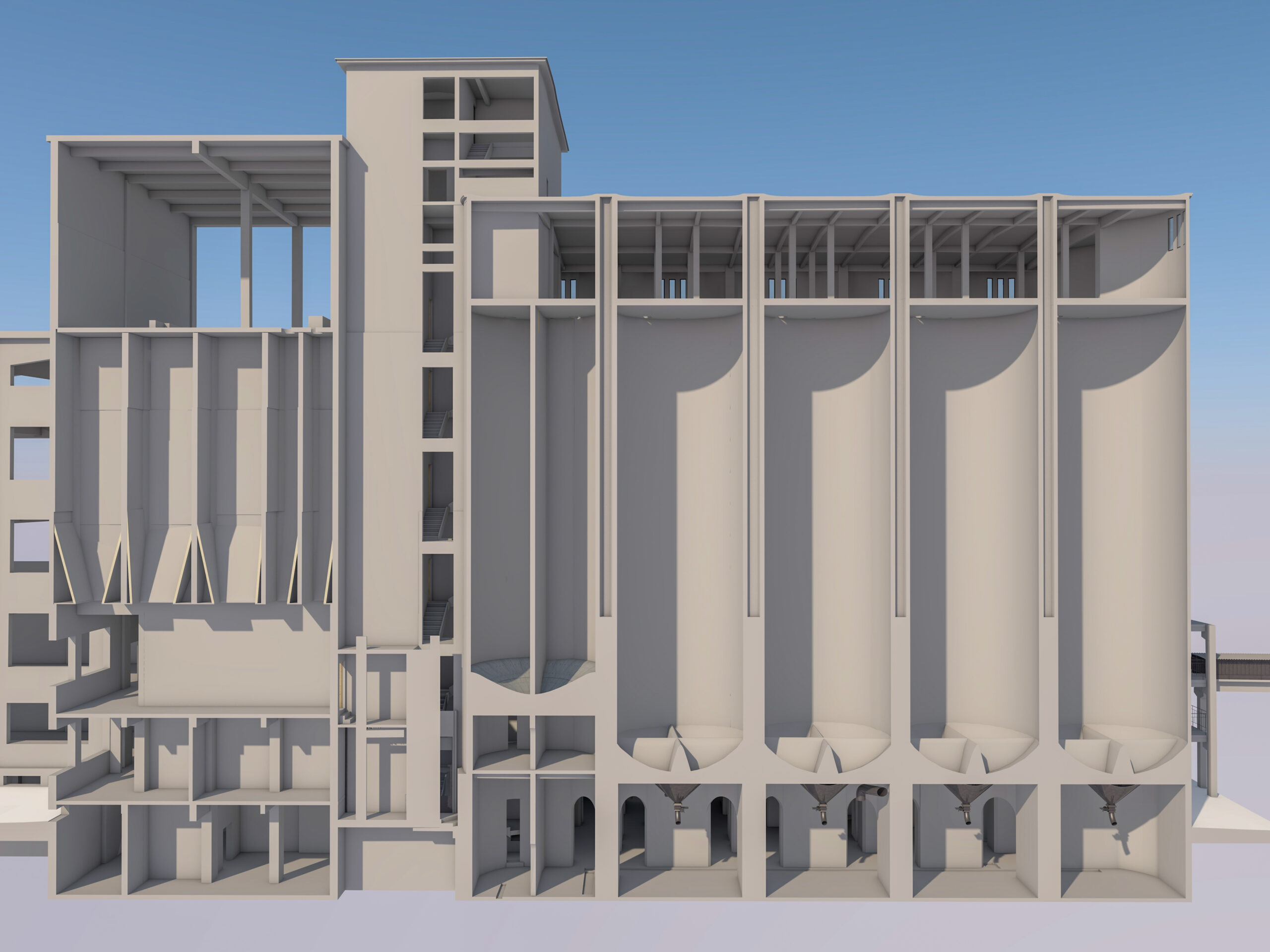
Survey and 3D modelling of an industrial building

Due to the volume (height and surface) of the silos of the mill in Baciu, the only surveying method that ensures accuracy, speed, low effort and maximum security of on-site data collection is 3D scanning. The cloud of points is 100% accurate and complex, which allows the realization of the 3D CAD model of the building assembly, helping designers to develop an optimal solution for changing the function of the building.Pe lângă parcurgerea tuturor încăperilor de la nivelul subsolului până la acoperișul tip terasă necirculabilă, scannerul laser 3D a fost coborât și în fiecare siloz, relevând în întregime toate suprafețele clădirii. Norul de puncte fiind o bază 100% completă și precisă, a fost posibilă realizarea unui model 3D CAD a construcției, ajutând echipa de arhitecți în găsirea unei soluții cât mai optime din punct de vedere structural, economic și spațial pentru reconversia fostei clădiri cu caracter industrial într-o funcțiune nouă.

Case study

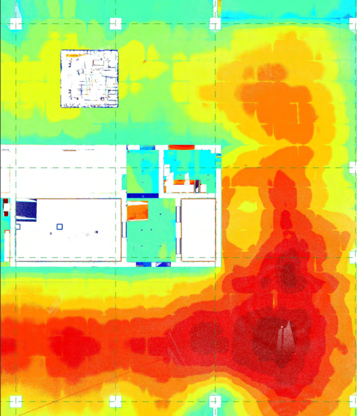
The support and analysis of a construction process

The purpose of the 3D survey was to check the bending of the monolithic reinforced concrete slab. The cloud of points was recoloured in relation with the differences from the designed situation. The verification was carried out by comparing that with the 3D CAD model, where by closing the color shade the bending of the plate could be observed.

Case study

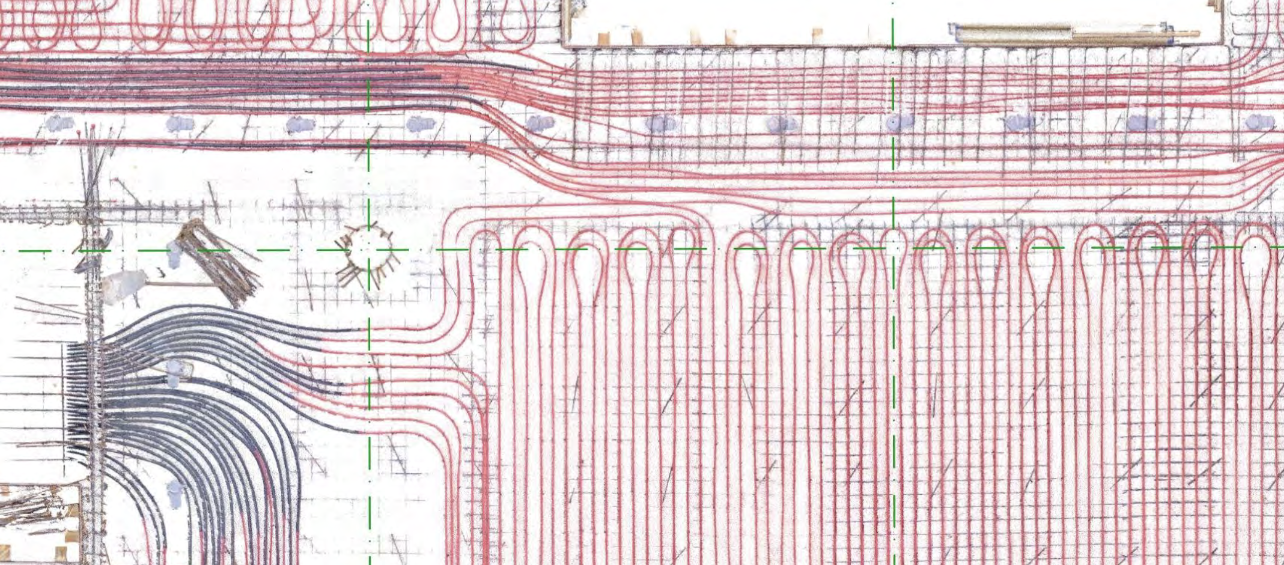
Documentation of the construction process

The purpose of this 3D survey was to document the position of the buildings tempering pipe system, the post-tensioned cables, location of electrical boxes and lighting installations. In the future, if further interventions are required, with the help of the pointclouds it will be very easy to check where the slabs can be drilled or where these interventions can take place.

Ornaments of facades

The ornamental elements of the eclectic facade after the laser scanning passed through a density filter, so that a distance of 1 mm remained between the points, facilitating the creation of 2D technical drawings with a CAD program. The cloud of points was transformed into MESH, and a detailed 3D model is produced in the program using BIM elements. Thus it is easy to render the grandeur of the building in 3D format, which is more difficult with manual methods.

ORTOFOTO after a cloud of points

The surveying of a baroque gate was carried out at the same time as the scanning of the church of St. Peter and Paul in Cluj. For the 2D documentation of the gate it was decided to use orthophoto, taking into account the advantages of speed and details.

Detailed plan

Survey and 3D modelling of an industrial building

Survey and 3D modelling of an industrial building

Verificare de șantier

Scopul scanării 3D constă în verificarea deformărilor intradosului planșeului de beton armat monolit, tip dală, de peste subsol 3 după decofrare, zonele marcate cu roșu reprezintănd săgeata acestuia. Norul de puncte este reprezentat prin culori distincte, a căror intensitate variază, în funcție de diferențele dintre cota inferioară a planșeului decofrat și cota inferioară proiectată a planșeului respectiv. Verificarea s-a realizat prin compararea modelului 3D CAD cu norul de puncte printr-un procedeu automat, astfel se pot realiza comparări de volume complexe, nu doar față de un plan predefinit.

Documentare de șantier

Scanarea 3D s-a realizat pentru a verifica și a documenta, la o precizie milimetrică, poziția țevilor de temperare, a toroanelor de post-tensionare și a dozelor electrice și corpuri de iluminat, ele fiind înglobate în planșeele de beton armat monolit, tip dală, cu intrados de beton aparent. În cazul unor intervenții ulterioare, verificând în norul de puncte se va evita deteriorarea țevilor și a dozelor, prin găurirea sau carotarea planșeului de beton armat monolit, tip dală. Scanările 3D s-a desfășurat pe o perioadă de aproximativ un an, în paralel cu execuția planșeelor.


Contact

Street ACAD. DAVID PRODAN, Number 12,
CLUJ-NAPOCA

E. office@fragmentum.ro
T. 0364 730 158
T. +40 771 146 389

social networks

Facebook-f

Useful links

  • Scan 3d
  • Services
  • Portfolio
  • About us
  • Contact
all rights reserved © fragmentum
WordPress Design and Development by WebGurus

We are using cookies to give you the best experience on our website.

You can find out more about which cookies we are using or switch them off in settings.

Powered by  GDPR Cookie Compliance
Privacy Overview

This website uses cookies so that we can provide you with the best user experience possible. Cookie information is stored in your browser and performs functions such as recognising you when you return to our website and helping our team to understand which sections of the website you find most interesting and useful.

Strictly Necessary Cookies

Strictly Necessary Cookie should be enabled at all times so that we can save your preferences for cookie settings.

If you disable this cookie, we will not be able to save your preferences. This means that every time you visit this website you will need to enable or disable cookies again.